
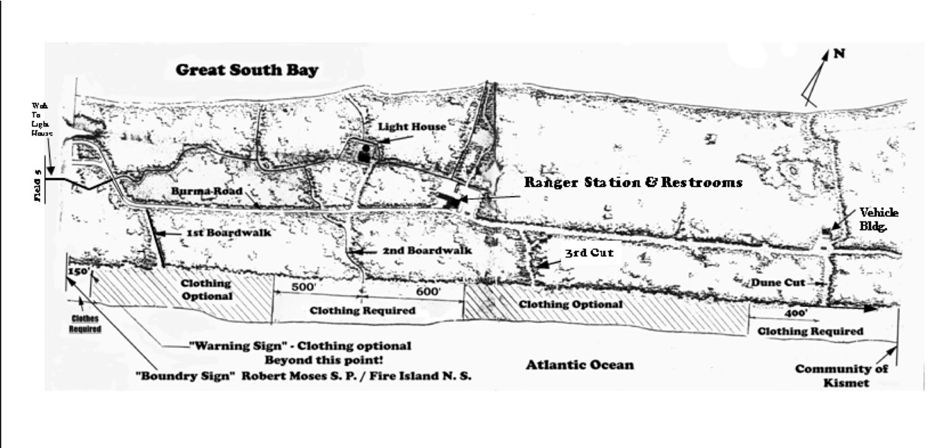
Detailed Maps of Lighthouse Beach Fire Island
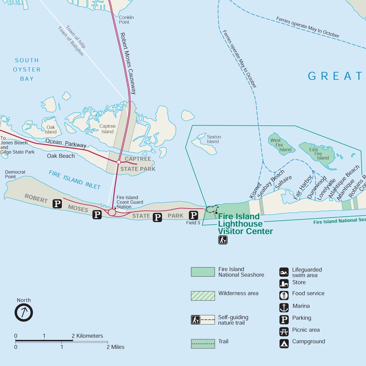
Area Map showing Robert Moses State Park and Lighthouse Beach Areas

Lighthouse Beach West Clothing-Optional
Lighthouse Beach Top-free Allowed
Lighthouse Beach East a.k.a. Kismet West Clothing-Optional
THIS SITE ABOUT LIGHTHOUSE BEACH IS PROVIDED BY THE LONG ISLAND TRAVASUNS
NOTE: Do to the popularity of the clothing optional section, in recent years the 150’ buffer zone indicated on the western end of this map has been eliminated by FINS. The clothing optional section now begins at the boundary line between Robert Moses S.P. and FINS

ttttt